PURFRAME
PURFRAME
PurFrame Aerial Projects

The drone shot.
Without the drone.

Type any US address. Get a cinematic Aerial Project — photos and video — delivered in minutes. No pilot. No scheduling. No weather delays.

Free first look · No credit card required

Daytime · Close
751 Bay Ave Somers Point, NJ 08244 USA
The math on a single property

A $1,000 shoot for $10.

Traditional Drone Pilot
$500 – $1,500
+ scheduling, weather delays, editing turnaround
PurFrame Aerial Project
$10 – $20
Ready in minutes · All three aspect ratios delivered
Try it free

Your property.
From the sky.

Enter any US address. We'll render three aerial angles of that property and email you the download link.

Photos too — not just video

Just need the stills?

Every Aerial Project can output as photo-only. Same photorealistic drone shots — landscape, 9:16, and square — without the motion. Perfect for MLS hero images, print collateral, Instagram grids, and one-page property flyers when you need the shot but not the sizzle reel.

Delivered in
3 aspect ratios
16:9 · 9:16 · 1:1
Real properties · Real refinement

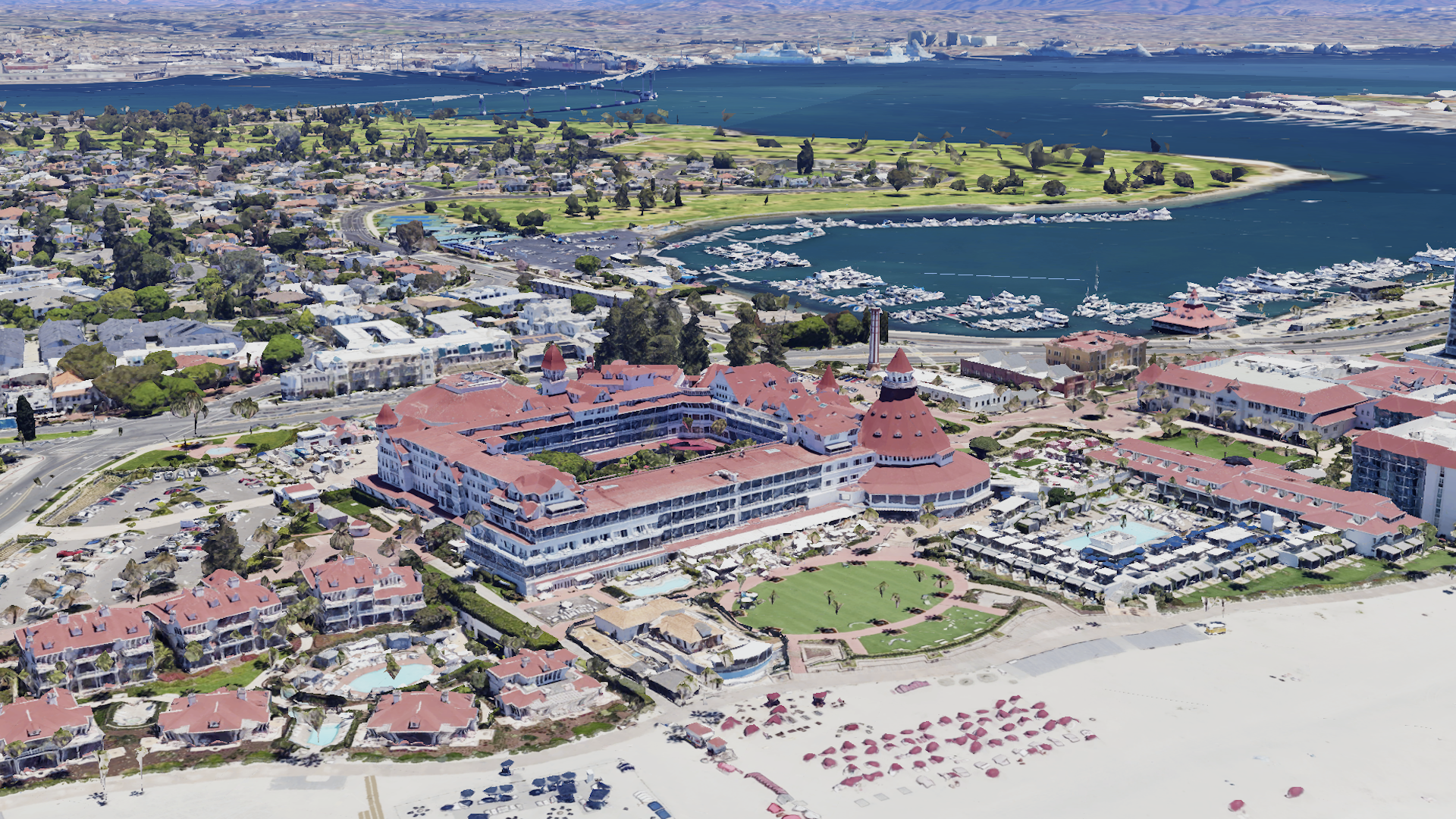
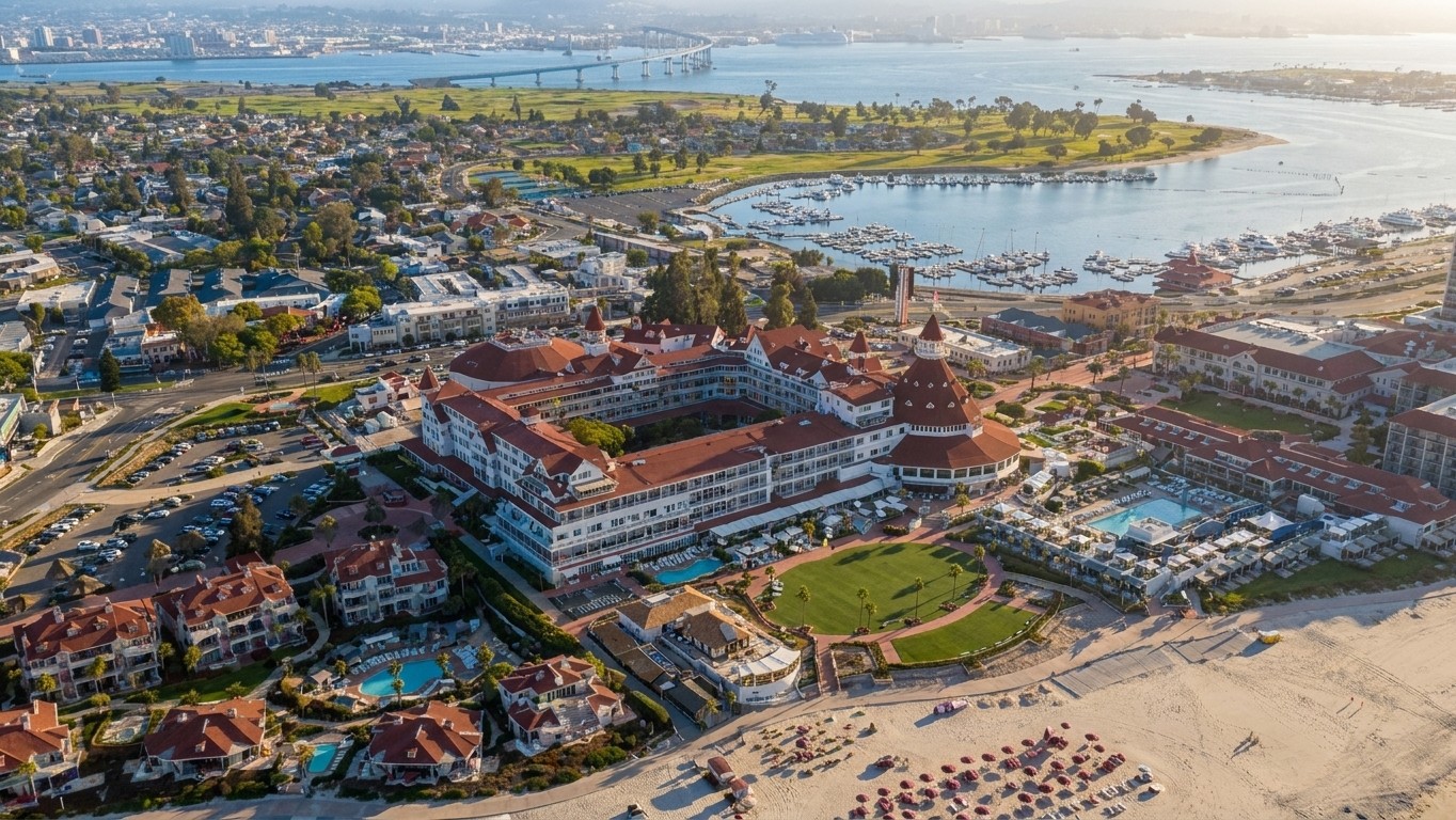
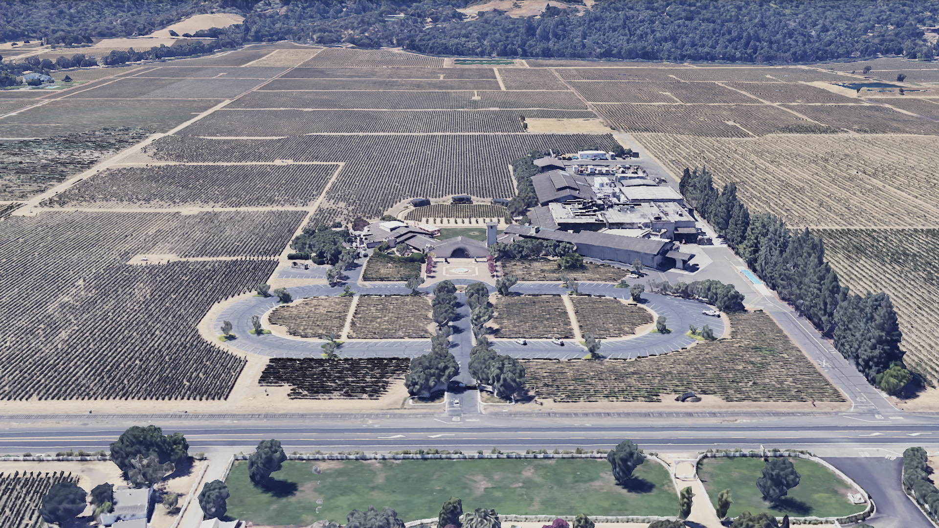
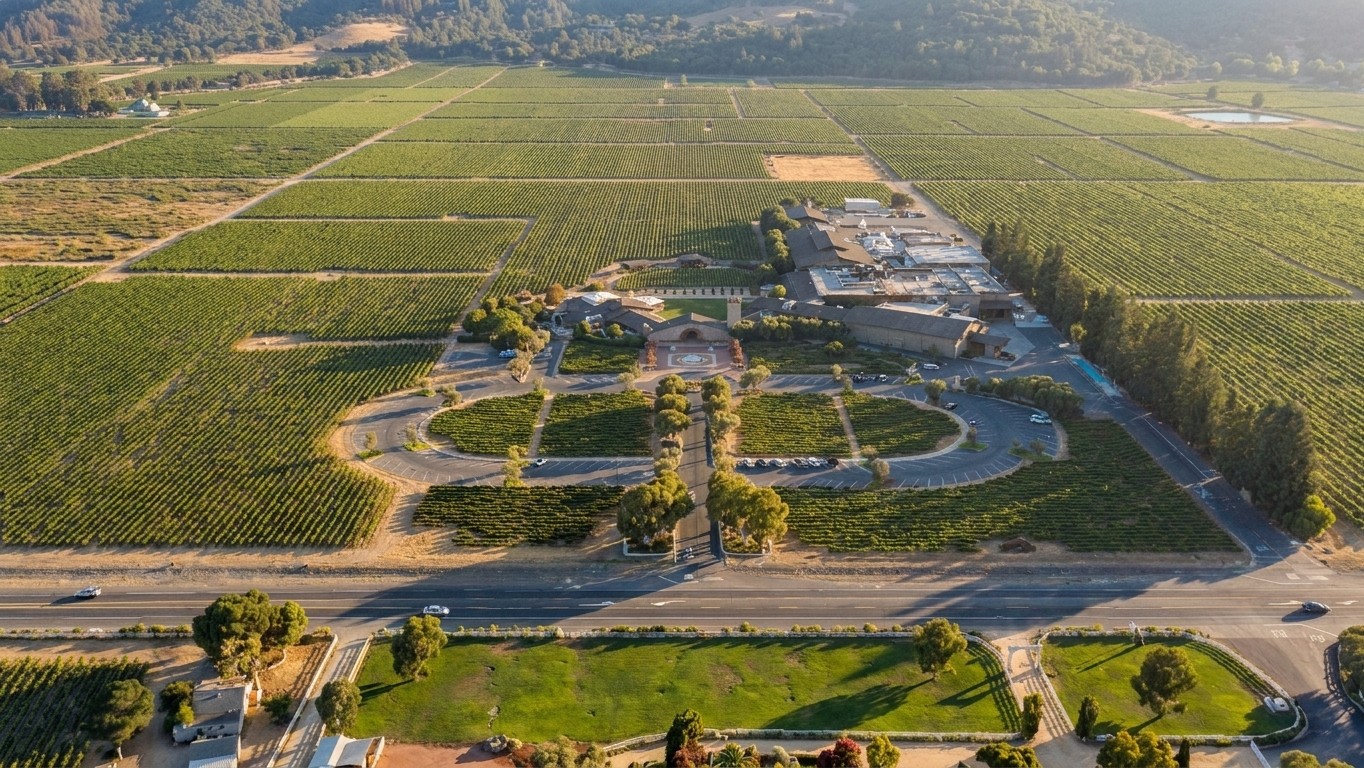
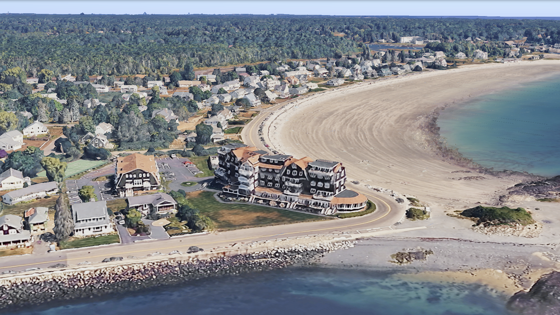
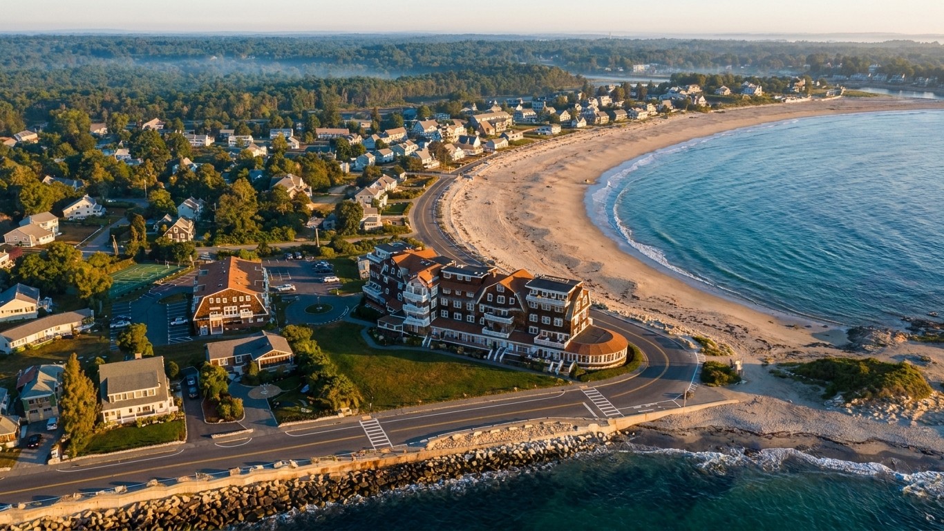
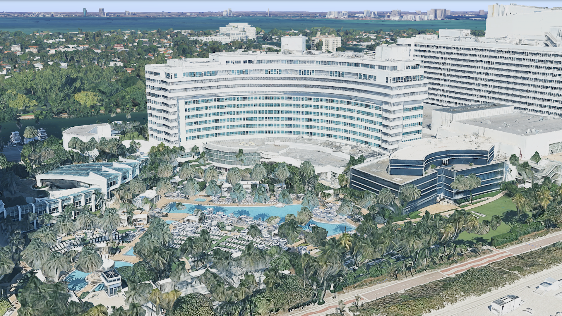
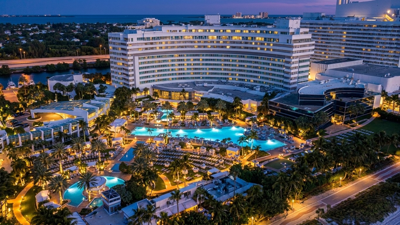
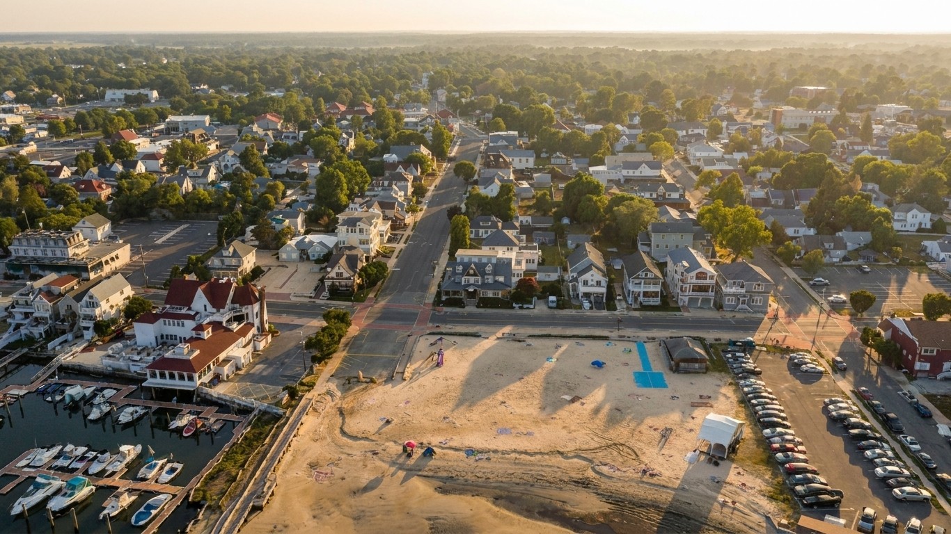
Blocky 3D tiles → photoreal drone quality.

Every Aerial Project starts as Google's raw 3D tile view. Our pipeline turns it into a photorealistic drone shot with proper lighting, sharp geometry, and real surface textures. Same address, dramatic difference.
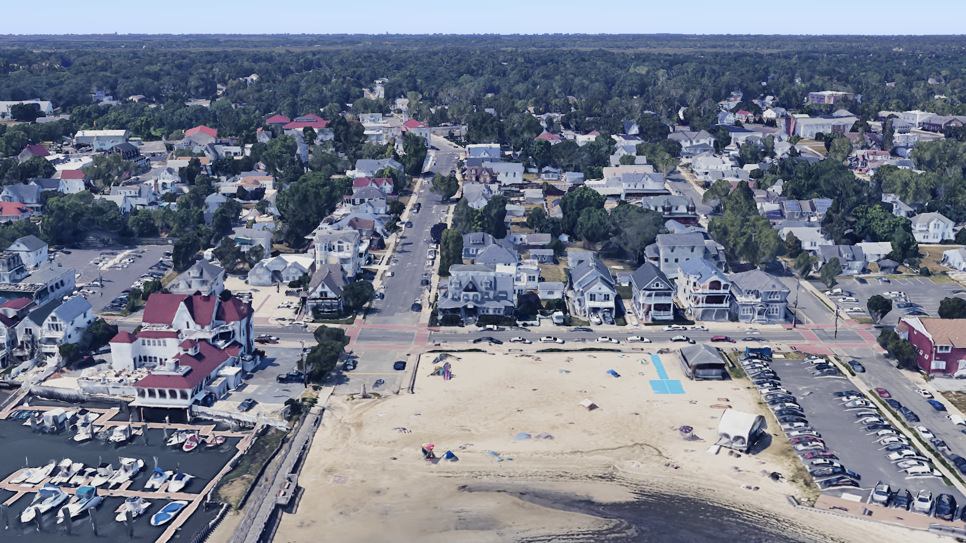
Google 3D tile view of 751 Bay Ave, Somers Point NJ · Euro Line Designe
Before · Google 3D tiles
PurFrame refined aerial of 751 Bay Ave, Somers Point NJ · Euro Line Designe
After · PurFrame
751 Bay Ave, Somers Point NJ · Euro Line Designe
Google 3D tile view of 1500 Orange Ave, Coronado CA · Hotel del Coronado
Before · Google 3D tiles
PurFrame refined aerial of 1500 Orange Ave, Coronado CA · Hotel del Coronado
After · PurFrame
1500 Orange Ave, Coronado CA · Hotel del Coronado
Google 3D tile view of 7801 St Helena Hwy, Oakville CA · Robert Mondavi Winery
Before · Google 3D tiles
PurFrame refined aerial of 7801 St Helena Hwy, Oakville CA · Robert Mondavi Winery
After · PurFrame
7801 St Helena Hwy, Oakville CA · Robert Mondavi Winery
Google 3D tile view of 149 Beach Ave, Kennebunk ME · Narragansett By the Sea
Before · Google 3D tiles
PurFrame refined aerial of 149 Beach Ave, Kennebunk ME · Narragansett By the Sea
After · PurFrame
149 Beach Ave, Kennebunk ME · Narragansett By the Sea
Google 3D tile view of 4441 Collins Ave, Miami Beach FL · Fontainebleau
Before · Google 3D tiles
PurFrame refined aerial of 4441 Collins Ave, Miami Beach FL · Fontainebleau
After · PurFrame
4441 Collins Ave, Miami Beach FL · Fontainebleau
How it works

Address in. Cinematic aerial out.

1

Enter the address

Type any US address. Preview the property in our interactive 3D globe. Drag the pin if the geocode is off (common for rural lots).

No permit. No scheduling. No travel.
2

Pick your shots

Close approaches, wide reveals, city context, top-down. Mix and match daytime, sunset, and twilight lighting for the same property.

3 lightings × 4 distances = 12 possible looks.
3

Get your delivery

Photos in landscape, 9:16, and square. Videos in the same three aspect ratios. Hosted on a share page or download the originals.

Perfect for MLS, Zillow, Airbnb, Instagram.

Built for the built world.

High-end visual software for the people who market physical property.

Real Estate Agents

Twilight aerials + wide neighborhood context are what buyers scroll for. Every listing gets the "high-end MLS look."

Vacation Rentals

Refresh Airbnb & Vrbo photos with cinematic aerials every season. Twilight shots make luxury rentals stand out.

Architects & Builders

Show clients the site + neighborhood context around your design. Present spec builds before the drywall is up.

Land & Acreage

Show buyers the size of the parcel and its surroundings — the story rural listings can't tell with interior photos.

Commercial & Industrial

Warehouses, office parks, mixed-use, land parcels. Overhead shots show layout, adjacencies, parking.

Photographers & Media

White-label PurFrame as an aerial add-on to your existing packages. Wholesale pricing, retail margins.

How PurFrame compares.

How PurFrame compares to traditional drones and other AI listing video tools.

PurFrameAutoReelReel-EDrone Pilot
Address-only input
Aerial video included
Interior tour included
TurnaroundMinutesMinutesMinutes3–14 days
Per-property cost$10–20~$25~$25$500–$1,500
Weather / schedulingNoneNoneNoneConstant
FAA Part 107 pilot needed
Multiple aspect ratiosExtra fee

Competitor pricing and features accurate as of August 2026 based on public pricing pages.

Common questions

How does it work without an actual drone?
We start with Google's photorealistic 3D tile data — the same 3D map layer that powers Google Earth. Our AI pipeline refines the raw 3D tile view of your address into a photorealistic aerial photograph, then animates it into a cinematic drone-style video. The geometry of the property (roofline, lot boundary, landscaping) comes from real satellite + street-view data, so the output is spatially accurate.
What if the address geocode is wrong for my property?
Common for rural properties, waterfront lots, golf courses, marinas. Our capture UI lets you drag the subject pin to the exact structure before rendering. Takes 5 seconds.
Can I use these for MLS listings?
Yes — outputs are photorealistic, high-resolution, and delivered in the three aspect ratios MLS/Zillow/Instagram all use. As with any digitally-generated media, we recommend disclosing "AI-assisted aerial" in your listing description if your MLS requires it (rules vary by state — check your local MLS handbook).
Can I get just the photos, without the video?
Yes. Every Aerial Project can output as photo-only — you get the same photorealistic drone stills in landscape, 9:16, and square, without the motion. Perfect for MLS hero images, print collateral, and Instagram grids.
What resolution do I get?
Photos: 1920×1080 landscape, 1080×1920 portrait, 1080×1080 square. Videos: same three aspect ratios at 1080p, 5–10 seconds, MP4 (H.264). Higher-res options available for luxury listings on request.
How is this different from just using Google Earth?
Google Earth's raw 3D tiles look blocky — jagged rooflines, stretched textures, flat-shaded buildings. See the before/after grid above for the visual gap. Our pipeline turns that raw tile data into refined photorealistic drone imagery with proper lighting, sharp geometry, real surface materials, and cinematic color grading.
Do you support all US properties?
Yes for anywhere Google has 3D tile coverage — which is essentially every populated area in the US. Rural / remote areas with only 2D satellite coverage will render at lower fidelity. Best results in cities, suburbs, and established neighborhoods.
What lighting options are there?
Three: Daytime (bright midday, MLS-standard), Sunset (warm golden hour, best for social + luxury), Twilight (blue hour with interior + landscape lights ON — the signature luxury real estate look). Same property, three completely different moods.
What about privacy for the properties in your marketing?
The aerials shown on this page are all case study properties (Euro Line Designe showroom, Hotel del Coronado, Robert Mondavi Winery, Narragansett By the Sea condo, Fontainebleau) — all publicly-marketed commercial destinations with permission or public-figure status.
Every property, three moods

Daytime · Sunset · Twilight

Daytime
Bright midday. Standard MLS look. Cool blue sky.
Sunset
Warm golden hour. Long shadows. Social-ready.
Twilight
Blue hour. Interior + landscape lights ON. Luxury.

Powered by PurFrame Aerial Suite™.

Every listing deserves the aerial.

Start with any US address. See the output before you commit.

Free first look · Delivered by email · No credit card